Washoe County Photo

Fawn Lane Tentative Subdivision Map Update

The Tentative Subdivision Map for the Ascente Subdivision was first approved on June 6, 2017.  Included with the many Development Code required conditions was a pedestrian/equestrian path along Fawn Lane. With the ongoing construction of the Ascente Subdivision,...

photo of a horse in a stable with the words Equine Business Code Draft Update, and the Washoe County logo

Equine Business Code Draft Update now available, survey open

The Washoe County Planning Division has completed a draft of the equine business code, which is available online and can be viewed here: Equine Business Annotated Draft. Planners will host several opportunities in the coming weeks to provide feedback on the draft...

image of a golf course

Washoe Golf status report 2025

Industry Overview The golf industry continues to benefit from sustained participation growth that began during the COVID-19 pandemic. Golf emerged as a leading outdoor recreation option in 2020, and participation levels have remained strong in subsequent years. ...

Sandbag locations restocked as New Year’s weather approaches

Washoe County is reminding residents and drivers to stay vigilant as wet weather approaches, which may increase the risk of localized flooding on roads and in neighborhoods as Nevada rings in the new year. Residents looking to prepare can access sandbag locations...

Washoe County Photo

Washoe County and FEMA update Swan Lake and Silver Lake floodplain risk maps using latest mapping technology to inform residents of flood risks

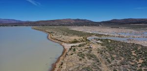
Washoe County, in alignment with the Federal Emergency Management Agency (FEMA) requirements and obligations, has updated flood hazard information using the latest data and mapping technology in the Swan Lake and Silver Lake areas of Washoe County. The remapping effort focuses on updating the FEMA Flood Insurance Rate Maps (FIRM) that identify the 1 percent risk (100-year) flood risks around Swan Lake and Silver Lake. This is one of several areas in Washoe County to be analyzed and remapped.